The hows and whys of heatwaves explained as the West Midlands bakes
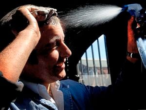
With the West Midlands in the grip of a heatwave and temperatures set to rise again by the end of the week, read up on what makes a heatwave, why it is happening now and if it is likely to happen more often.

What is a heatwave?
It is defined by the Met Office as an uninterrupted period of exceptionally high temperatures. There’s a threshold temperature for it to be described as a heatwave, and it varies in different parts of the country. For the West Midlands, it is 27C (81F). The threshold has to be reached or exceeded for three days in a row for it to be called a heatwave. If it doesn’t last three days, it’s considered a mere hot spell. The current weather already places us in a heatwave and, while temperatures will dip later in the week, they will rise above 27F again by Saturday.

Why is it happening?
High pressure is stretching into Britain from the Atlantic Azores Islands, off the coast of Portugal. The so-called Azores High is trapping a bubble of rapidly warming air like a pressure cooker. It acts like a dome, keeping hot air inside and not allowing it to move away. Jet streams, which lie high in the atmosphere, have veered north, taking away any weather fronts. While Scotland can expect some rain this week, the West Midlands will stay dry.
Will we reach a record high?
It is very likely a record temperature will be recorded somewhere this week, probably in the south east. The current record stands at 38.7C (102F), at Cambridge University on July 25 2019. Forecasters say there is a real chance that 40C (104F) will be broken, probably over next weekend.

How can we be so sure?
We can’t be 100 per cent, but forecasts are now so much more accurate than even a decade ago, particularly when the weather is stuck in a pattern as it is now. Met Office deputy chief David Oliver said: “Weather forecast models are run hundreds of times to determine the most likely weather outcome. There are some runs, or solutions, that allow more extreme temperatures to develop into next weekend. This is something we are monitoring closely and which will add more detail on over the coming days.”
Will this happen more often?
While the frequency of extreme events such as these likely hasn’t changed much over the years, the severity has definitely increased. There also appears to be more hot extremes than cold extremes, suggesting hotter summers and milder winters ahead.