Thunderstorms forecast for Black Country again as Met Office issues 10-hour warning
It's the storm before the forecasted calm as the Met Office has issued warnings for thunderstorms ahead of a spell of more settled weather next week.

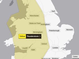
A yellow warning for storms for Thursday stretches across the whole of the Black Country and Staffordshire, as well as the rest of the West Midlands, Wales and the South West.
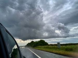
However the storms are likely to be hit and miss with many parts of the region managing to avoid them.
Neil Armstrong, a Met Office chief forecaster, said: “A period of showery conditions during summer always brings the possibility of some of those showers turning heavy and thundery, possibly with hail.
"Some of these showers will be slow-moving so that could increase local impacts with rainfall totals reaching 30mm or more in isolated locations. In the heaviest showers these could be accompanied by hail and lightning.”
The Met Office has warned that some places could see 10-20mm of rain within an hour, and a "small chance of 40 mm in 2-3 hours", with expected to persist for longer in parts of central England and the Midlands.
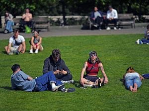
Mr Armstrong said the current regime of sunshine and showers will increasingly yield towards brighter and warmer conditions for many as an area of high pressure will build from the South West later next week.
"Temperatures are expected to remain around average or slightly below average over the weekend, but the forecast of diminishing showers from Monday opens the door for temperatures to rise," he added.