Parts of southern England to hit minus 9C in early hours amid cold snap
The Met Office said freezing fog will stay in place in some areas on Tuesday morning, with temperatures hovering just above minus 10C.

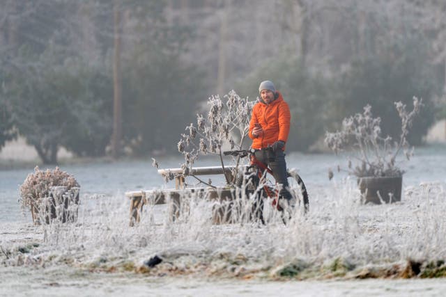
Parts of southern England will hit minus 9C in the early hours, with the cold snap set to last until the end of the week.
The Met Office said freezing fog will stay in place in some areas on Tuesday morning, with temperatures hovering just above minus 10C.
The UK Health Security Agency (UKHSA) extended a level 3 cold weather alert until 9am on Friday, with people urged to keep warm and check in on family and friends who may be more vulnerable.
As temperatures plunged to minus 9.5C in Santon Downham, Suffolk, on Sunday night, it was confirmed hundreds of households in England and Wales are eligible for cold weather payments.

They are made to vulnerable people, including pensioners, to help them pay for heating when the temperature dips below freezing.
It goes to those living in an area where the average temperature is recorded as, or forecast to be, 0C or below over seven consecutive days.
Payments will be made to homes across north-east England, Cumbria, west Wales and Oxfordshire.
Meanwhile, the Environment Agency has 34 flood warnings in place across England, meaning flooding is expected and action to prevent it should take place.
Met Office forecaster Craig Snell told the PA news agency: “We’ve got rather cloudy, damp but mild weather across Northern Ireland, Scotland and far north-west areas of England on Tuesday, temperatures could get up to 12C or 13C across Aberdeenshire way.
“Further south across the rest of England and Wales we’re still under the colder conditions, so there could be some fog again which will be quite slow to clear, so a very similar start to Monday.
“When there is cloud it’s going to feel pretty cold, but in the sunshine, although it will be cold, the sun will help negate the cold a little bit, so all in all a pretty similar day to Monday.
“Going into Wednesday we do see a change as the day goes on, we’ve got a cold front coming down from the north so that will move across Scotland and Northern Ireland during the morning and then gradually move across England and Wales during the afternoon.

“There will be some rain with it, turning brighter after it moves in, and the front will then pass on Thursday.”
He added: “Tuesday morning will probably be the coldest, with some parts of southern England getting down to minus 9C, hovering around minus 7C in the early hours of Wednesday.”
It comes as Mayor of London Sadiq Khan issued a high air pollution alert for the capital for Tuesday.
Mr Khan said: “We know how dangerous toxic air is for Londoners – that’s why I’m doing everything in my power to tackle it. On Tuesday, alongside the extreme cold temperatures we’ve been experiencing, we are also expecting high levels of air pollution.
“Following the latest forecast from Imperial College London, I am issuing a ‘high’ air pollution alert. This shows once again why it’s so vital that we expand the Ultra Low Emission Zone London-wide to reduce toxic air pollution in our city.
“We all need to be careful over the next few days. I’m urging Londoners to look after each other by choosing to walk, cycle or take public transport where possible, avoiding unnecessary car journeys, stopping engine idling and not burning garden waste, all of which contributes to high levels of pollution.
“This is particularly important in order to protect those who are more vulnerable to high pollution.”


