UK’s coldest night of the winter so far recorded in Scottish Highlands
The temperature at Altnaharra was minus 16.7C, the coldest temperature recorded there since 2010, the Met Office said.
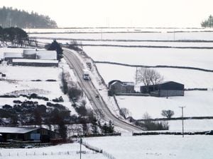
The coldest night of the winter so far in the UK has been recorded as minus 16.7C in the Scottish Highlands, as snow and ice continue to cause disruption in some regions.
The temperature at Altnaharra was recorded on Tuesday morning and is the coldest temperature recorded there since 2010, Met Office spokesperson Nicola Maxey said.
She said temperatures could plunge further on Wednesday night into Thursday, but that conditions across the UK are set to get milder towards the weekend.
Meanwhile police in Norfolk warned of blizzard-like conditions and said many roads had fallen victim to snowdrifts and blockages, as they urged people not to travel if they can avoid it.
Officers attended a number of minor road traffic collisions on Monday and police in King’s Lynn said that a lorry got stuck in a snowdrift and had to be towed out by farmers.
More than 380 schools in Norfolk were closed to all children, including vulnerable children and those of key workers, on Tuesday due to the adverse weather.
Vaccination centres in Ipswich and Bury St Edmunds in Suffolk and Clacton on Sea and Colchester in Essex remained closed on Tuesday due to the severe weather.
Swimmer Victoria Carlin, 40, braved the chilly waters of the Thames Estuary at Thorpe Bay in Essex on Tuesday morning.
She said it was the coldest conditions she has ever swum in, with her partner recording the temperature as minus 0.1C in the air and 1.4C in the water using a meat thermometer.

“It really took my breath away actually,” said Ms Carlin, who runs a private tuition company.
“We have snow so irregularly in this country, it was just ‘we’ve got to be in the water’ this last couple of days, just to experience being in there.
“I think everyone thinks we’re a bit nutty when they’re watching from the railings at the top.
“We’ve had a few people taking pictures of us and saying we’re mad, but it keeps us going back so there must be something about it.”
Ms Maxey said there was anecdotal evidence that 10cm to 15cm of snow fell in south east coastal areas at the start of the week.

“There’s still a risk of snow anywhere down the eastern side of the UK,” she said.
“We’re in these cold easterly winds.
“The cold air crosses from Russia and eastern Europe, crosses the sea, picks up some moisture then when it hits the land you see rain or because the air’s so cold you see snow.”
Some snow is likely to continue through Tuesday and Wednesday but “more showery rather than large accumulations”, she said.

Ms Maxey said the UK had a “glancing blow from the northern edge” of Storm Darcy, which crossed northern Europe and was named by the Dutch weather service.
She said Storm Darcy pulled away from the UK on Monday.
Temperatures will widely be below freezing overnight across the country and in low single figures in the daytime on Tuesday and Wednesday, she said.

“It certainly looks as though towards the end of the weekend we might see daytime temperatures move up a little bit,” said Ms Maxey.
“Certainly by the time you get to Sunday in London you might be looking at quite widely 6C.
“So less cold, but expectations are that Wednesday into Thursday might be the coldest night of the spell so far and then we see things pick up a little bit.”