More rain on the way for Black Country and Staffordshire
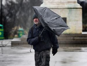
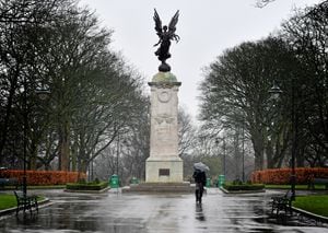
More rain is on the way to the Black Country and Staffordshire after the region woke up to a rainy February morning instead of predicted snowfall.
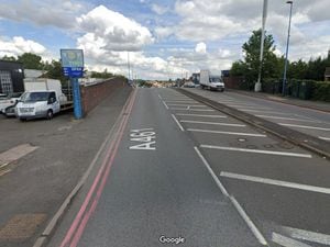
Forecasters said more wet weather is on the way as Bewdley Bridge closed earlier this morning as flood alerts were put in place.
The Met Office initially ramped up its warnings for snow and ice, with several hours of sleet and snow predicted across Thursday morning.
While other parts of the UK have been hit by snow and some schools have closed, the Black Country has so far remained unscathed.
The forecast for the next few days of the Met Office website said: "This evening will start with another band of rain moving in from the south. A very wet night start to the night, with rain easing and turning patchy only towards dawn. Breezy.
"Friday morning will start with largely cloudy skies and a few showers lingering. Gradually turning drier through the afternoon with bright spells developing towards the evening.
"Saturday will see early cloudy clear away, leaving plenty of wintry sunshine through the rest of the day. Light to gentle winds. Staying calm on Sunday, with any early local mist and fog clearing to variable cloud and bright spells. A chance of a shower in places too. Monday will see a similar day, with variable cloud, bright spells and some showers or spots of rain possible."
Up to 25cm of snow is forecast in parts of England and Wales on Thursday, as the Met Office issued weather alerts and warned of disruption to travel.
Amber weather warnings for snow have been issued for parts of northern England and north Wales, while a mixture of yellow rain and snow warnings will be in force across the four nations.
The amber warning across the Peak District and south Pennines is in place from noon until 6pm on Thursday, with up to 25cm of snow forecast across high ground above 300 metres.
A separate amber warning for snow and ice will be in place between 8am and 3pm on Thursday across north Wales and north-west Shropshire, with 20-25cm of snow forecast in areas above 200 metres.
The Met Office said that as milder air begins to arrive from the south, there is a chance that snow could turn to “freezing rain across some higher routes above 200 metres”.