Watch this dramatic footage recorded in the eye of Hurricane Irma
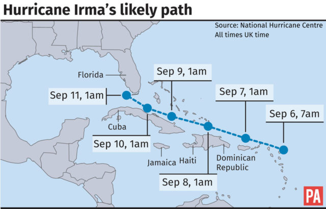
The category 5 storm is the most powerful Atlantic Ocean hurricane in history.

Heavy rain and winds have battered large parts of the Caribbean, as Hurricane Irma continues its assault through the region.
But the Category 5 storm, which has been recorded as the most powerful Atlantic Ocean hurricane ever, can now be viewed through this dramatic plane footage.
The Florida-based research centre uses the dedicated plane to fly through hurricanes and monitor weather changes. The data is fed back to scientists and forecasters.
Irma’s 185mph winds have downed phone lines in Barbuda and sent debris flying in Antigua since it landed on Tuesday.
British tourists have been urged to follow warnings, with the Foreign Office saying in a statement: “The authorities in Puerto Rico and Florida have declared a state of emergency. You should follow the advice of the local authorities and any evacuation orders.”