
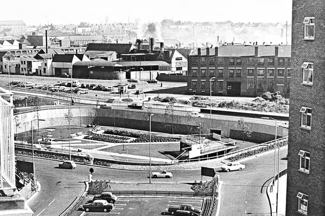

First mapped out in the mid-1950s and built in stages throughout the 1960s, 1970s and early 1980s, Wolverhampton's inner ring road transformed the town centre. Historic pubs, terraced streets and industrial sites gave way to multi-lane carriageways, concrete flyovers and sunken pedestrian subways.
Captured from high above the traffic and at ground level in its mosaic-lined underpasses and sunken gardens, these archive photographs offer a fascinating look at the changing landscape, the ambitious engineering behind the project and the everyday lives of the drivers and pedestrians who used it.
The photographs are presented in no particular order, but together they capture the changing face of Wolverhampton's ring road. Do you remember it being built, or have memories of using it over the years? Share your memories in the comments – we'd love to hear them.
- You can enjoy this and more with our weekly FREE Nostalgia Newsletter - with scores of archive pictures and exclusive features on the history of Wolverhampton, Staffordshire and the Black Country - all sent to your inbox every week. Sign up here
- For anyone curious about where their own family story leads, MyHeritage DNA kits are currently £19.90, excluding shipping. The test can help explore genetic origins and identify DNA matches who may share branches of your family tree. This is an affiliate link. We may earn a small commission on items purchased, but that does not affect our editorial judgement
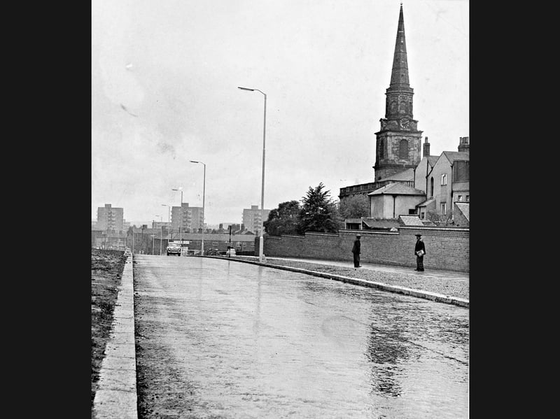
25. Empty tarmac awaits the rush on the newly opened stretch
Stretching out in a glistening, near-empty ribbon beneath the spire of St John's Church, a newly opened stretch of Wolverhampton's ring road sees barely a single car on July 14, 1961. Framed by tall street lamps, brick boundary walls, and distant post-war tower blocks, the scene was captured a week after the section opened to illustrate how word had yet to get around—leaving the fresh carriageway noticeably under-patronised by local motorists. | Express & Star archive
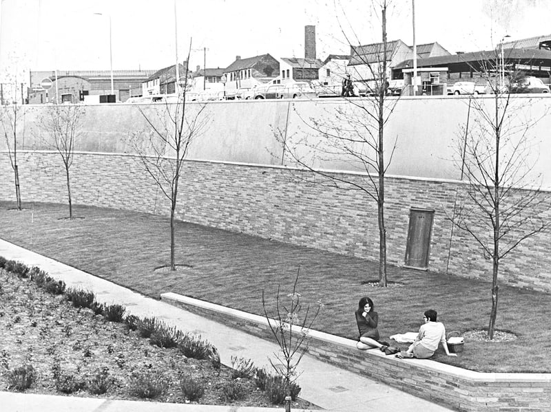
26. Sunken garden sanctuary beneath the Penn Road traffic
Relaxing on the low brick wall beside a picnic basket, two young women enjoy a quiet moment in the sunken gardens at the Penn Road roundabout junction of Wolverhampton's ring road on May 17, 1965. Framed by young saplings, landscaped flowerbeds, and towering brick-and-concrete retaining walls, the peaceful oasis was almost complete when it opened to strollers, offering a sheltered retreat just below the level of the passing traffic overhead. | Express & Star archive
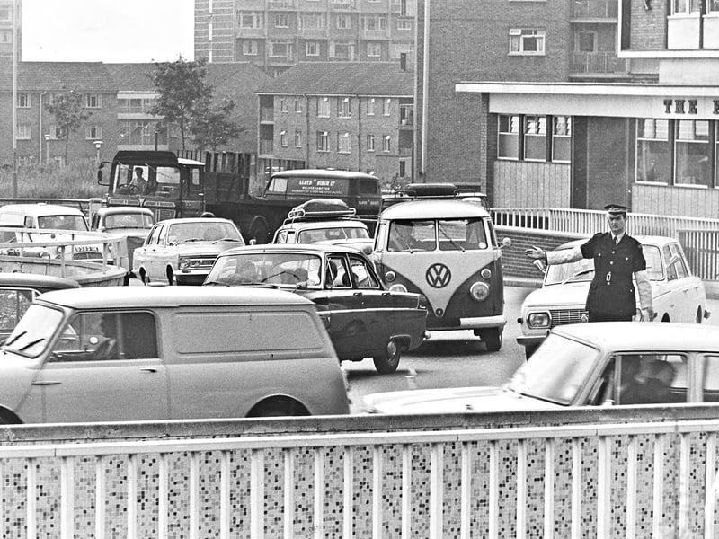
27. Friday rush hour gridlock at Worcester Street
Extending an arm to untangle the Friday evening rush, a traffic warden directs a classic VW camper van, a Mini van, and packed lanes of 1960s motors at the Worcester Street junction of Wolverhampton's ring road at 5.30pm on July 12, 1968. Framed by mosaic-tiled bridge parapets, brick-built flats, and a Lloyd Birch van in the background, the busy bottleneck captures the realities of peak-time commuter traffic navigating the town's growing road network | Express & Star archive
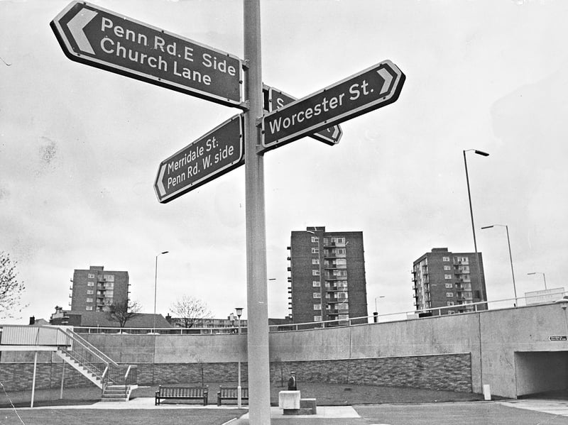
28. New signposts help strollers find their bearings in the sunken gardens
Rising above the paved walkways and wooden benches of the Penn Road roundabout sunken gardens, a freshly installed signpost points the way toward Worcester Street, Merridale Street, and Church Lane beneath Wolverhampton's ring road on July 29, 1965. Framed by concrete retaining walls, pedestrian steps, and post-war tower blocks on the skyline, the directional boards were erected to help visitors relaxing below traffic level navigate the adjoining streets without confusion. | Express & Star archive