
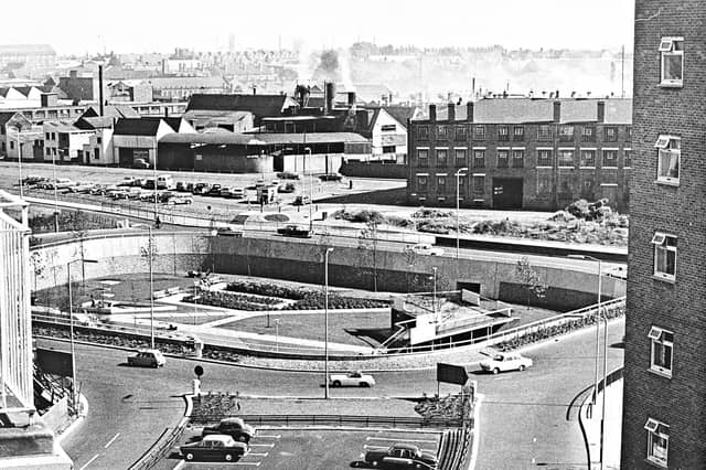

First mapped out in the mid-1950s and built in stages throughout the 1960s, 1970s and early 1980s, Wolverhampton's inner ring road transformed the town centre. Historic pubs, terraced streets and industrial sites gave way to multi-lane carriageways, concrete flyovers and sunken pedestrian subways.
Captured from high above the traffic and at ground level in its mosaic-lined underpasses and sunken gardens, these archive photographs offer a fascinating look at the changing landscape, the ambitious engineering behind the project and the everyday lives of the drivers and pedestrians who used it.
The photographs are presented in no particular order, but together they capture the changing face of Wolverhampton's ring road. Do you remember it being built, or have memories of using it over the years? Share your memories in the comments – we'd love to hear them.
- You can enjoy this and more with our weekly FREE Nostalgia Newsletter - with scores of archive pictures and exclusive features on the history of Wolverhampton, Staffordshire and the Black Country - all sent to your inbox every week. Sign up here
- For anyone curious about where their own family story leads, MyHeritage DNA kits are currently £19.90, excluding shipping. The test can help explore genetic origins and identify DNA matches who may share branches of your family tree. This is an affiliate link. We may earn a small commission on items purchased, but that does not affect our editorial judgement
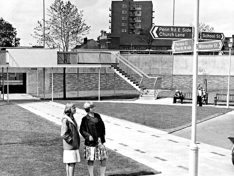
33. Schoolgirls test out the new sunken garden signposts
Looking up at newly erected directional signs in the sunken garden at the Worcester Street and Penn Road junction of Wolverhampton's ring road, 12-year-olds Denise Palmer of Graiseley Street and Barbara Fletcher of Merridale Street check their route on August 25, 1965. Framed by the elevated pedestrian walkway, brick-and-concrete retaining walls, and a post-war tower block rising beyond, the signposts were installed to help visitors navigate their way toward School Street, Worcester Street, Church Lane, and Penn Road. | Express & Star archive
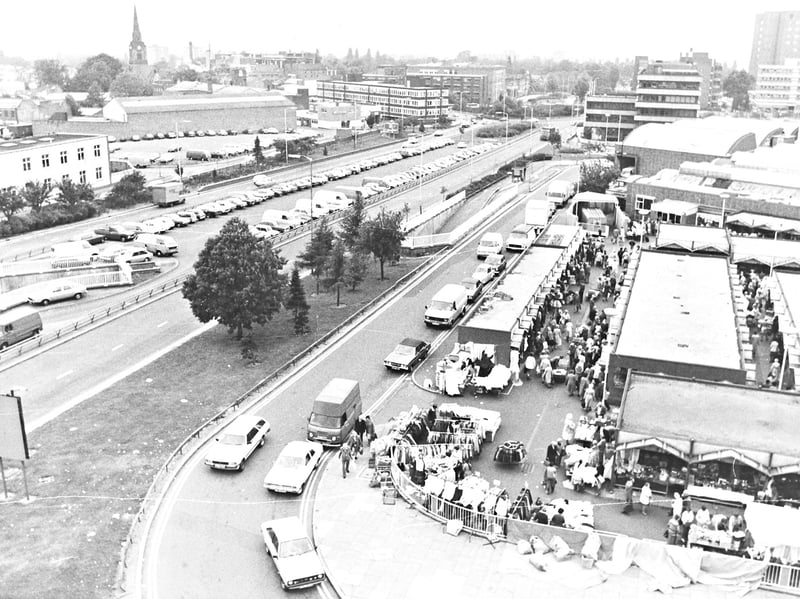
34. Busy open market trading beside the carriageway
Bustling with shoppers browsing rows of covered stalls, the Open Market at Brickkiln Croft and School Street sits directly alongside Wolverhampton's ring road in the 1970s. Looking across the tree-lined dual carriageway and its packed central car park toward the spire of St Mark's Church in Chapel Ash, the elevated view also captures piles of rubbish bags stacked neatly along the market's outer railings in the foreground. | Express & Star archive
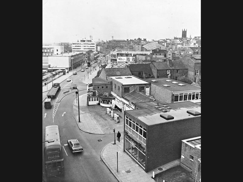
35. Elevated view of the Retail Market and busy junction
Captured from the new multi-storey garage at the junction of Wolverhampton's ring road, this elevated vantage point looks past a double-decker bus, flatbed lorry, and 1960s traffic toward the Retail Market on the left on May 8, 1967. Framed by a corner Mobil petrol station, traditional brick terraces, and the distant tower of St Peter's Church on the skyline, the scene highlights how modern concrete retail blocks and fresh road markings were reshaping the town centre. | Express & Star archive