
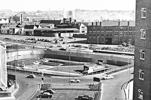

First mapped out in the mid-1950s and built in stages throughout the 1960s, 1970s and early 1980s, Wolverhampton's inner ring road transformed the town centre. Historic pubs, terraced streets and industrial sites gave way to multi-lane carriageways, concrete flyovers and sunken pedestrian subways.
Captured from high above the traffic and at ground level in its mosaic-lined underpasses and sunken gardens, these archive photographs offer a fascinating look at the changing landscape, the ambitious engineering behind the project and the everyday lives of the drivers and pedestrians who used it.
The photographs are presented in no particular order, but together they capture the changing face of Wolverhampton's ring road. Do you remember it being built, or have memories of using it over the years? Share your memories in the comments – we'd love to hear them.
- You can enjoy this and more with our weekly FREE Nostalgia Newsletter - with scores of archive pictures and exclusive features on the history of Wolverhampton, Staffordshire and the Black Country - all sent to your inbox every week. Sign up here
- For anyone curious about where their own family story leads, MyHeritage DNA kits are currently £19.90, excluding shipping. The test can help explore genetic origins and identify DNA matches who may share branches of your family tree. This is an affiliate link. We may earn a small commission on items purchased, but that does not affect our editorial judgement
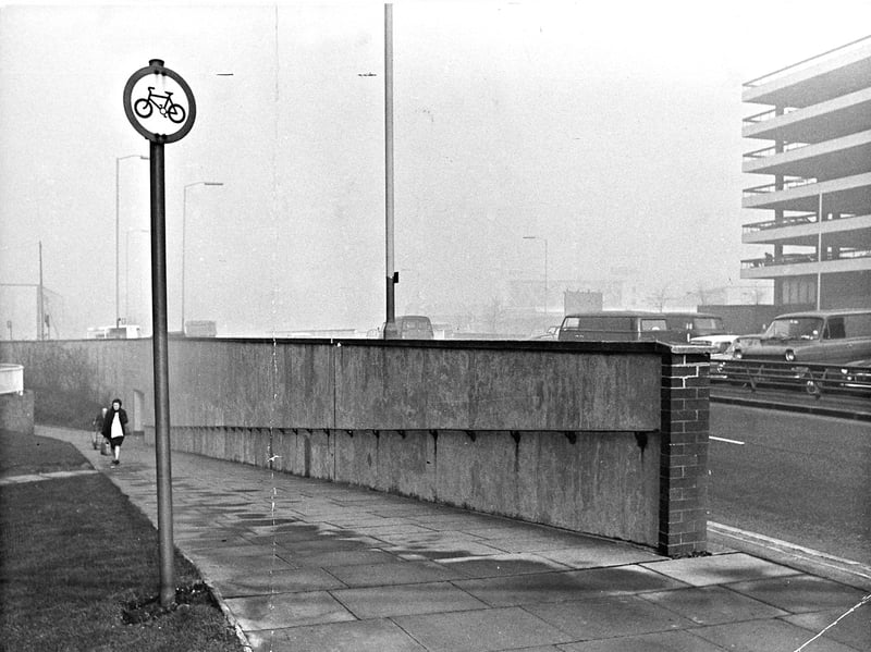
21. Pedestrian safety row over subway cycling signs
Walking up the sloped approach from the subway beneath Wolverhampton's ring road near Wolverhampton Market, a shopper passes a circular cycle sign that sparked a local debate over pedestrian safety on December 21, 1972. Framed by the concrete retaining wall, passing vans along the ring road, and the adjacent multi-storey car park, the photograph accompanied a newspaper letter arguing that the Highway Code sign banning cycles and mopeds looked too much like an invitation to ride blindly down the steep, sharp-angled walkway. | Express & Star archive
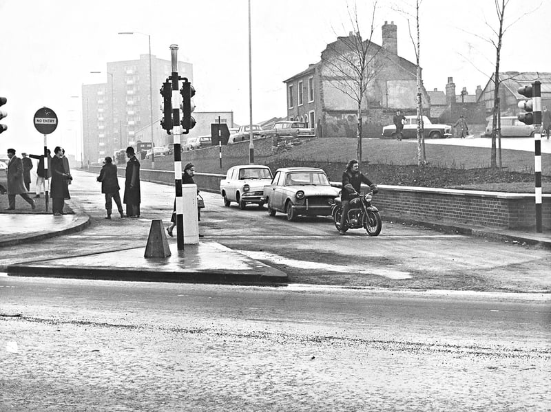
22. Unceremonious opening for the second section
Pulling away from the newly switched-on traffic lights, a motorcyclist and a string of 1960s saloons christen the £700,000 second section of Wolverhampton's inner ring road on February 5, 1965. Framed by wet tarmac, brick retaining walls, and partially demolished buildings near the Salop Street and Penn Road roundabout junctions, the low-key opening began at two-and-a-half minutes past noon when a traffic engineer pressed the button to power up the signals. | Express & star archive
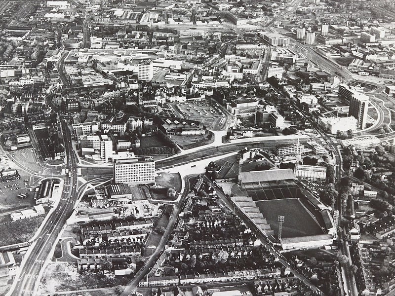
23. Landmarks and terraces meet the sweeping dual carriageway
Looking down from high above Molineux Stadium and the historic Molineux Hotel in June 1972, this sweeping aerial view captures Wolverhampton's ring road carving its path past rows of terraced housing and the School of Art. Stretching across the town centre skyline toward St Peter's Church, Darlington Street Methodist Church, and Mander House, the panorama highlights how the modern dual carriageway reshaped the urban landscape. | Express & Star archive
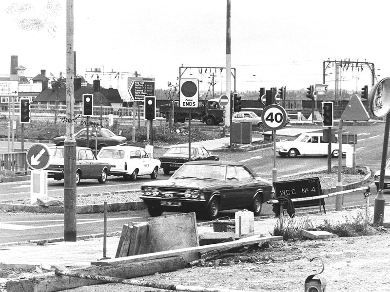
24. A jungle of traffic lights and signs at Broad Street
Navigating a dense forest of traffic signals, directional boards, and roadside barriers, 1970s motorists thread their way through Broad Street as work progresses on the latest stage of Wolverhampton's ring road on August 6, 1976. Costing more than £950,000, the major scheme introduced new dual carriageways between Stafford Street and Railway Street alongside a new canal bridge, creating what drivers dubbed a temporary "motorist's nightmare" ahead of completion. | Express & Star archive