
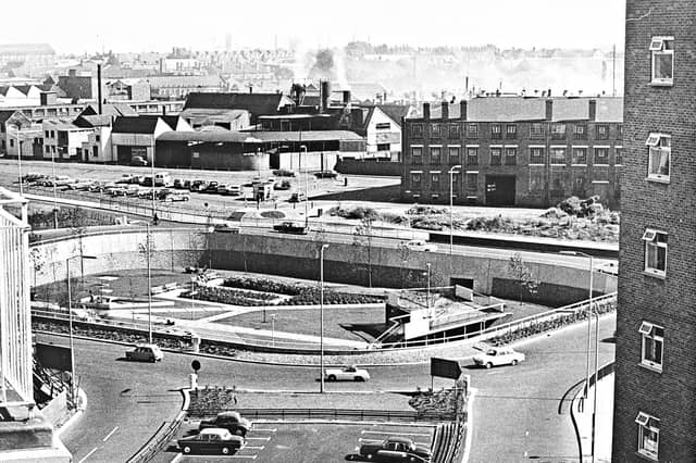

First mapped out in the mid-1950s and built in stages throughout the 1960s, 1970s and early 1980s, Wolverhampton's inner ring road transformed the town centre. Historic pubs, terraced streets and industrial sites gave way to multi-lane carriageways, concrete flyovers and sunken pedestrian subways.
Captured from high above the traffic and at ground level in its mosaic-lined underpasses and sunken gardens, these archive photographs offer a fascinating look at the changing landscape, the ambitious engineering behind the project and the everyday lives of the drivers and pedestrians who used it.
The photographs are presented in no particular order, but together they capture the changing face of Wolverhampton's ring road. Do you remember it being built, or have memories of using it over the years? Share your memories in the comments – we'd love to hear them.
- You can enjoy this and more with our weekly FREE Nostalgia Newsletter - with scores of archive pictures and exclusive features on the history of Wolverhampton, Staffordshire and the Black Country - all sent to your inbox every week. Sign up here
- For anyone curious about where their own family story leads, MyHeritage DNA kits are currently £19.90, excluding shipping. The test can help explore genetic origins and identify DNA matches who may share branches of your family tree. This is an affiliate link. We may earn a small commission on items purchased, but that does not affect our editorial judgement
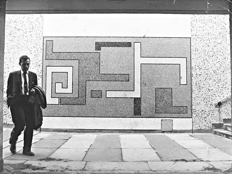
29. Subway mosaics spark a row over public art
Striding past a bold geometric mosaic in the Darlington Street island pedestrian subway, a suited commuter walks beneath Wolverhampton's ring road on July 17, 1968. Designed by consultant architects using motifs from the borough's coat of arms, the tiled artwork drew sharp criticism from a local resident who dismissed it as "rubbish" and the work of "some itinerant tattooist"—prompting council engineers to defend the Civic Trust award-winning scheme as a matter of personal taste. | Express & Star archive
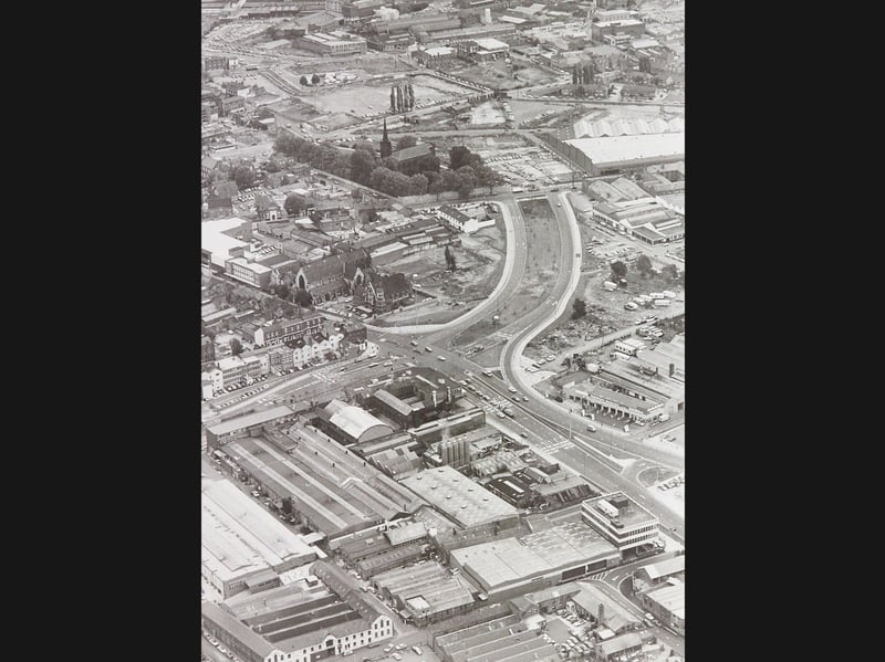
30. Bird's-eye view of the new Snowhill to Cleveland Road stretch
Curving cleanly between Snowhill and Cleveland Road before coming to an abrupt halt at the former Raby Street entrance, the newly completed section of Wolverhampton's ring road dominates this aerial view on September 22, 1981. Framed by the Cleveland Road bus depot, the tree-lined St George's Church awaiting demolition, and the sprawling Graiseley Industrial Estate in the foreground, the photograph captures a town centre in rapid transition. | Express & Star archive
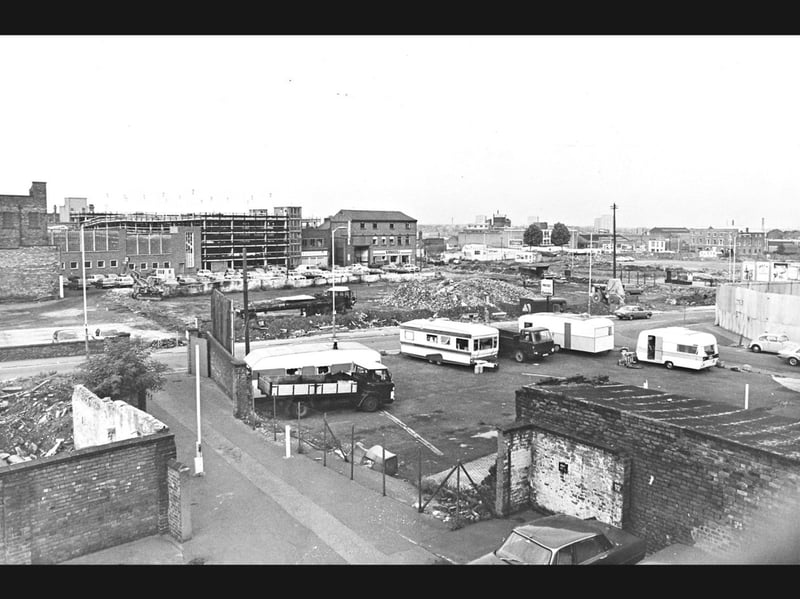
31. Rubble and demolition clear the way at Bilston Street
Captured from the fire escape of the College of Adult Education in Old Hall Street, this elevated view reveals mounds of rubble and parked caravans across a cleared Bilston Street site making way for Wolverhampton's ring road on October 2, 1981. Occupying the former plots of John Ireland's garage and the well-known Blue Ball pub, the flattened expanse was being prepared for a major new roundabout and a widened town-centre approach ahead of the scheme's scheduled completion in 1982. | Express & Star archive
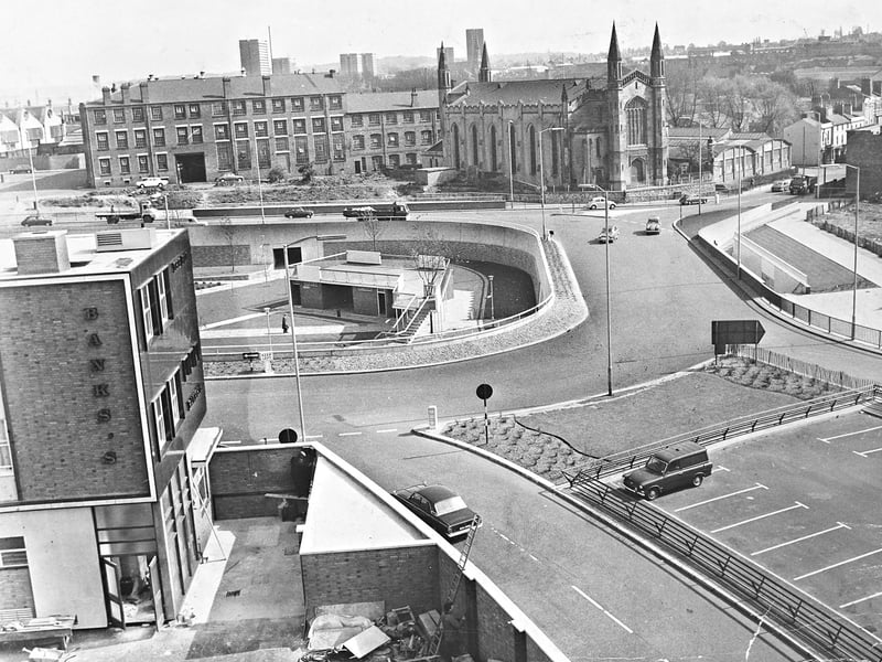
32. Elevated view across the sunken gardens and St Paul's Church
Captured from the top of the new multi-storey car park at the Penn Road roundabout junction, this elevated view looks across the sunken gardens and St Paul's Church beside Wolverhampton's ring road on May 10, 1967. Framed by a Banks's building in the foreground, brick industrial works, and distant post-war tower blocks, the scene captures light 1960s traffic circling the modern island walkways. | Express & Star archive