
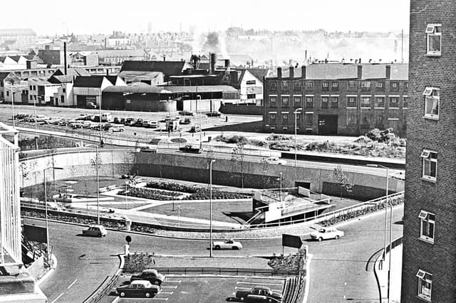

First mapped out in the mid-1950s and built in stages throughout the 1960s, 1970s and early 1980s, Wolverhampton's inner ring road transformed the town centre. Historic pubs, terraced streets and industrial sites gave way to multi-lane carriageways, concrete flyovers and sunken pedestrian subways.
Captured from high above the traffic and at ground level in its mosaic-lined underpasses and sunken gardens, these archive photographs offer a fascinating look at the changing landscape, the ambitious engineering behind the project and the everyday lives of the drivers and pedestrians who used it.
The photographs are presented in no particular order, but together they capture the changing face of Wolverhampton's ring road. Do you remember it being built, or have memories of using it over the years? Share your memories in the comments – we'd love to hear them.
- You can enjoy this and more with our weekly FREE Nostalgia Newsletter - with scores of archive pictures and exclusive features on the history of Wolverhampton, Staffordshire and the Black Country - all sent to your inbox every week. Sign up here
- For anyone curious about where their own family story leads, MyHeritage DNA kits are currently £19.90, excluding shipping. The test can help explore genetic origins and identify DNA matches who may share branches of your family tree. This is an affiliate link. We may earn a small commission on items purchased, but that does not affect our editorial judgement
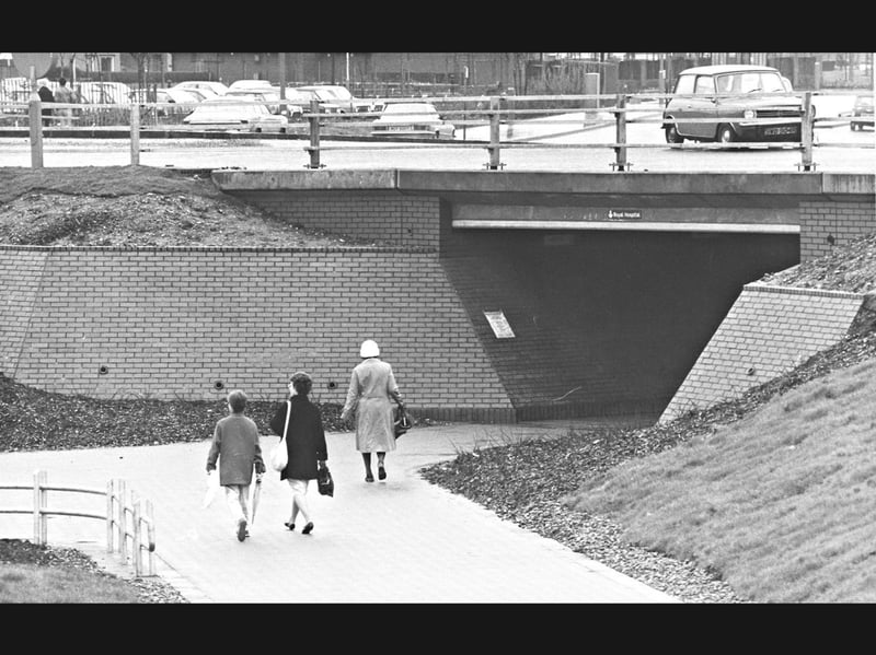
17. Shoppers head toward the Royal Hospital underpass
Walking briskly down the sloped concrete path with shopping bags in hand, three pedestrians approach a brick-lined subway beneath Wolverhampton's ring road during the 1980s. Framed by planted embankments, metal guardrails, and a small sign pointing toward the Royal Hospital above the tunnel mouth, the scene captures everyday foot traffic passing safely beneath a classic Mini and parked cars overhead. | Express & Star archive
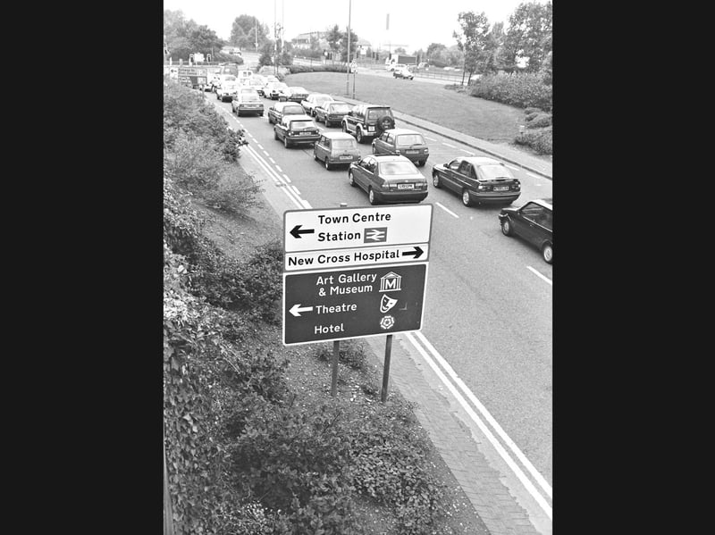
18. Queuing past the town centre signposts
Backing up along the dual carriageway, rows of 1980s hatchbacks, saloons, and a classic Mini queue past a large roadside signpost on Wolverhampton's ring road during the 1980s. Framed by leafy, overgrown verges, the sign points motorists toward the town centre, railway station, and New Cross Hospital, alongside local landmarks including the Art Gallery and Museum and the Grand Theatre. | Express & Star archive
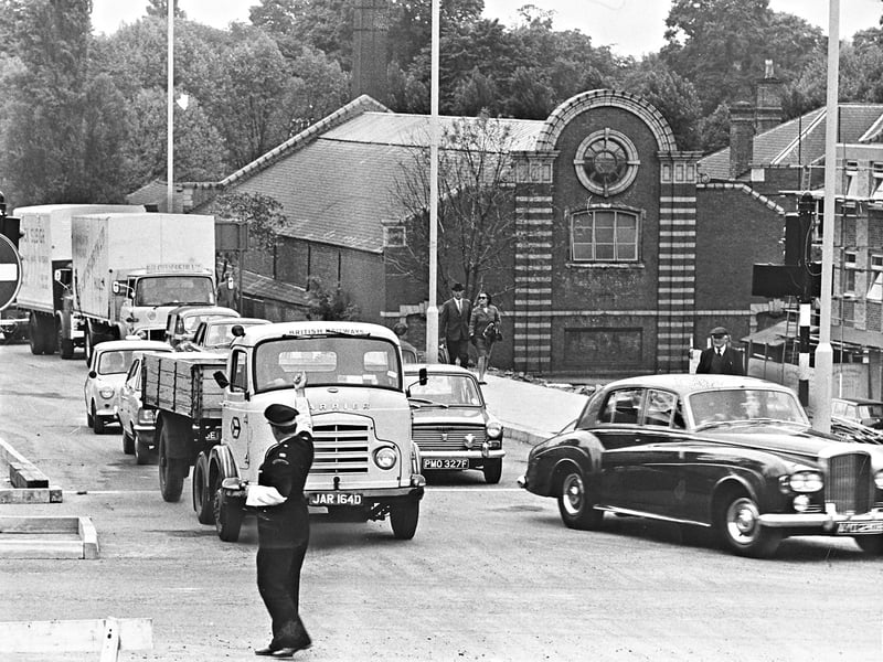
19. Traffic wardens take charge at the Waterloo Road junction
Stepping straight into the middle of the Waterloo Road and Bath Road junction, a traffic warden directs a British Railways flatbed lorry, a gleaming Bentley, and a queue of 1960s motors on June 12, 1968, minutes after the remainder of section three of Wolverhampton's ring road came into operation. Framed by newly installed no-entry signs and the distinctive striped brickwork of the building behind, the switchover converted the former two-way stretch between Darlington Street and Waterloo Road into a one-way carriageway while opening the new link from Chapel Ash. | Express & Star archive
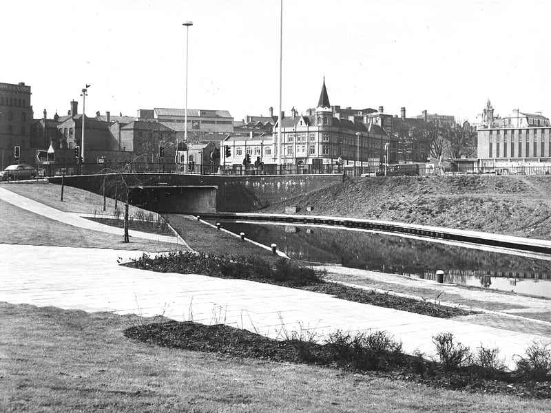
20. Calm canal waters meet the modern bridge
Disappearing beneath a newly built concrete bridge, the still waters of the canal cut quietly under Wolverhampton's ring road on May 18, 1978. Framed by freshly landscaped grassy banks, paved towpaths, and young saplings in the foreground, the scene contrasts the Victorian industrial buildings and turret-topped roofs beyond with the sleek geometry of the modern road network. | Express & Star archive