
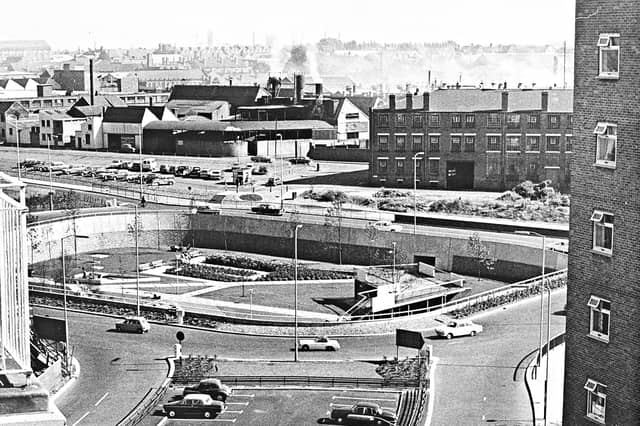

First mapped out in the mid-1950s and built in stages throughout the 1960s, 1970s and early 1980s, Wolverhampton's inner ring road transformed the town centre. Historic pubs, terraced streets and industrial sites gave way to multi-lane carriageways, concrete flyovers and sunken pedestrian subways.
Captured from high above the traffic and at ground level in its mosaic-lined underpasses and sunken gardens, these archive photographs offer a fascinating look at the changing landscape, the ambitious engineering behind the project and the everyday lives of the drivers and pedestrians who used it.
The photographs are presented in no particular order, but together they capture the changing face of Wolverhampton's ring road. Do you remember it being built, or have memories of using it over the years? Share your memories in the comments – we'd love to hear them.
- You can enjoy this and more with our weekly FREE Nostalgia Newsletter - with scores of archive pictures and exclusive features on the history of Wolverhampton, Staffordshire and the Black Country - all sent to your inbox every week. Sign up here
- For anyone curious about where their own family story leads, MyHeritage DNA kits are currently £19.90, excluding shipping. The test can help explore genetic origins and identify DNA matches who may share branches of your family tree. This is an affiliate link. We may earn a small commission on items purchased, but that does not affect our editorial judgement
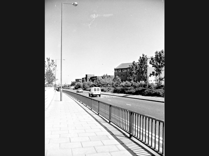
13. Quiet traffic and leafy verges past the Royal Mail depot
Cruising past the metal pedestrian railings and paved footpath, a white delivery van and a saloon car travel along Wolverhampton's ring road during the 1980s. Framed by tall street lamps and mature greenery along the central reservation, the scene looks across the A4124 carriageway toward the brick buildings and Royal Mail premises bordering the route. | Express & Star archive
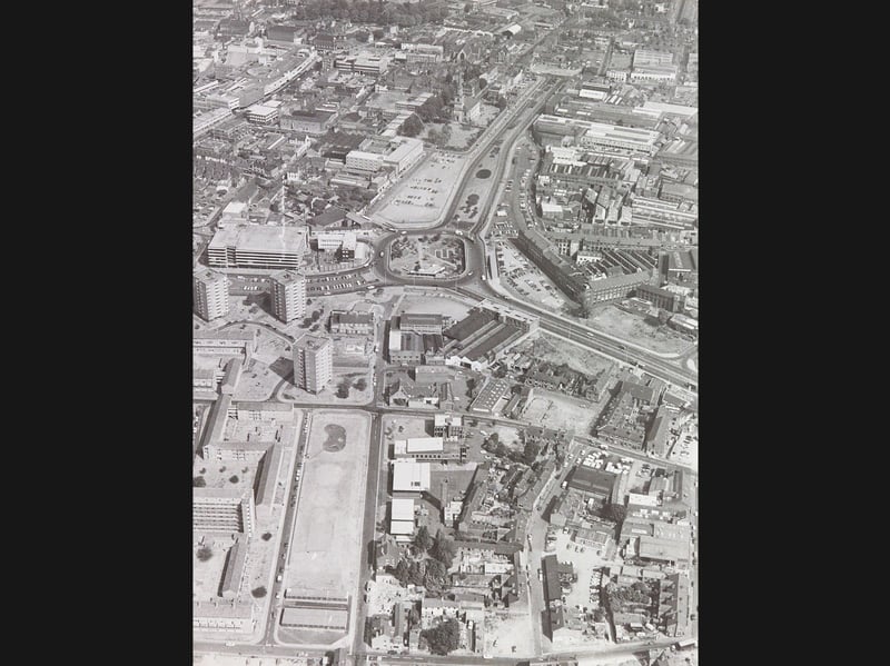
14. High-altitude view across the town centre and St John's Church
Soaring high above Wolverhampton on August 20, 1976, this sweeping aerial photograph captures the completed ring road cutting a bold curve through the town centre past the historic spire of St John's Church. Framed by post-war tower blocks, multi-storey car parks, and dense industrial works, the bird's-eye panorama illustrates how modern dual carriageways and landscaped roundabouts reshaped the town's skyline. | Express & Star archive
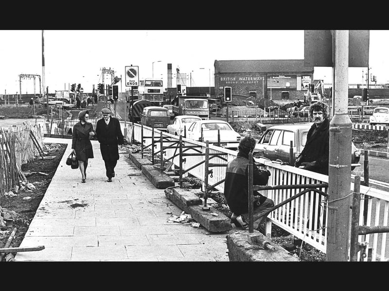
15. Forest of signs and railings rises at Broad Street
Strolling along a newly paved footpath beside workmen erecting white metal guardrails, a couple passes a steady queue of 1970s traffic on section five of Wolverhampton's ring road on April 7, 1976. Framed by the British Waterways Broad Street Depot, railway overhead gantries, and a sprouting thicket of new traffic signals and signs, the scene captures ongoing road alterations reshaping the town's busy northern approach. | Express & Star archive
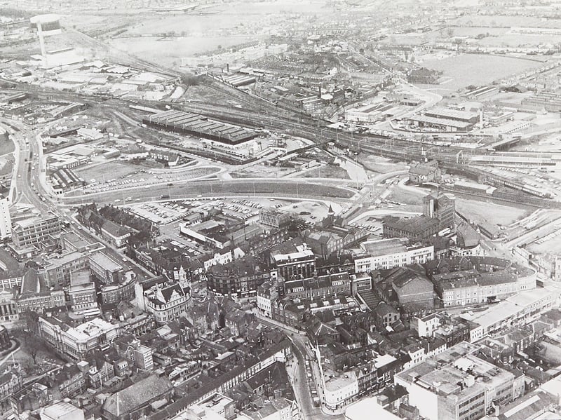
16. Sweeping aerial vista across the town centre and railway
Looking down from high above the rooftops on February 17, 1977, this sweeping bird's-eye view captures the broad curve of Wolverhampton's ring road cutting between the historic town centre and the sprawling railway lines. Framed by St Peter's Collegiate Church and civic buildings in the foreground, the dual carriageway runs past open surface car parks and dense industrial works stretching out toward the horizon. | Express & Star archive