
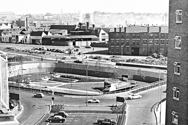

First mapped out in the mid-1950s and built in stages throughout the 1960s, 1970s and early 1980s, Wolverhampton's inner ring road transformed the town centre. Historic pubs, terraced streets and industrial sites gave way to multi-lane carriageways, concrete flyovers and sunken pedestrian subways.
Captured from high above the traffic and at ground level in its mosaic-lined underpasses and sunken gardens, these archive photographs offer a fascinating look at the changing landscape, the ambitious engineering behind the project and the everyday lives of the drivers and pedestrians who used it.
The photographs are presented in no particular order, but together they capture the changing face of Wolverhampton's ring road. Do you remember it being built, or have memories of using it over the years? Share your memories in the comments – we'd love to hear them.
- You can enjoy this and more with our weekly FREE Nostalgia Newsletter - with scores of archive pictures and exclusive features on the history of Wolverhampton, Staffordshire and the Black Country - all sent to your inbox every week. Sign up here
- For anyone curious about where their own family story leads, MyHeritage DNA kits are currently £19.90, excluding shipping. The test can help explore genetic origins and identify DNA matches who may share branches of your family tree. This is an affiliate link. We may earn a small commission on items purchased, but that does not affect our editorial judgement
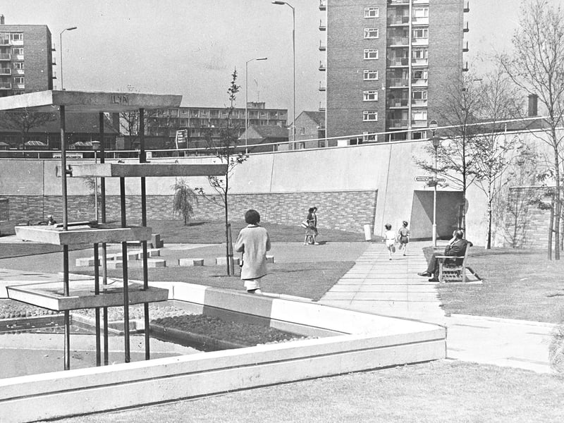
5. Quiet strolls and local debate at Penn Road island
Strolling past the tiered concrete fountain and crisp walkways, pedestrians make their way through the newly created sunken garden and subways at the centre of the Penn Road roundabout junction on the Wolverhampton Ring Road in July 1966. While Wolverhampton Corporation was already considering plans for a similar sunken garden at the junction of Darlington Street and Chapel Ash, the modern urban layout sparked lively debate among locals after observations showed only dozens of passers-by pausing briefly in the space each day. | Express & Star archive
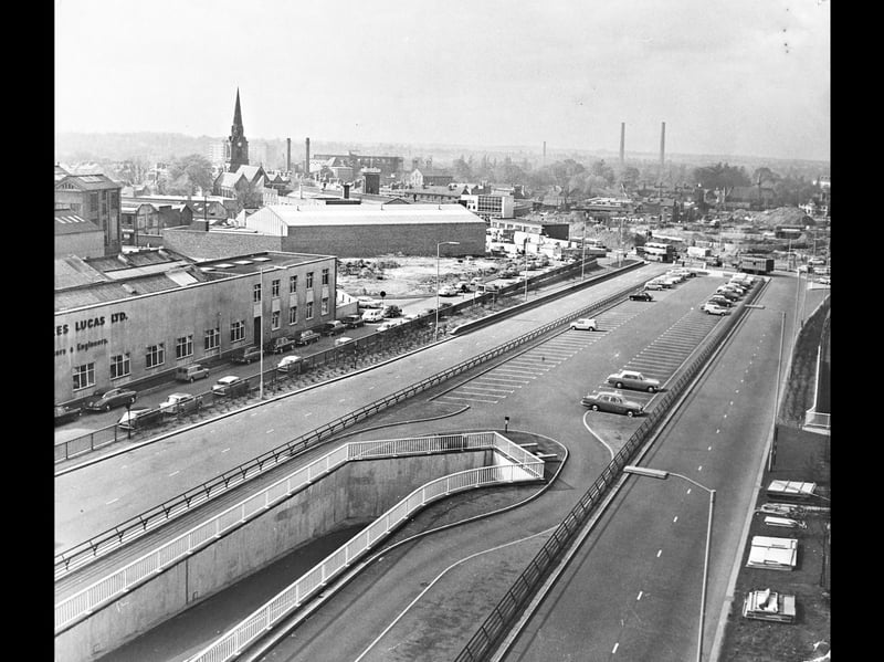
6. Central reservation parking near the Retail Market
Framed by sweeping dual carriageways and white-railed pedestrian subways, neat rows of saloons occupy the newly developed surface car park nestled right in the median of Wolverhampton's ring road near the Retail Market in May 1967. Flanked by the industrial façade of Charles Lucas Ltd and distant church spires, the scene captures a striking blend of old and new as 1960s urban planning took full effect. | Express & Star archive
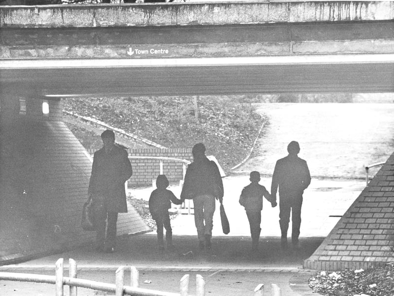
7. Silhouettes beneath the concrete underpass
Silhouetted against the bright daylight beyond, a family group and a solitary commuter walk through one of the concrete pedestrian subways beneath Wolverhampton's ring road during the 1980s. Framed by sloped brick-lined walls, metal guardrails, and a sign pointing down toward the town centre, the snapshot captures everyday life navigating the sunken walkways designed to keep shoppers safely separated from the busy traffic overhead. | Express & Star archive
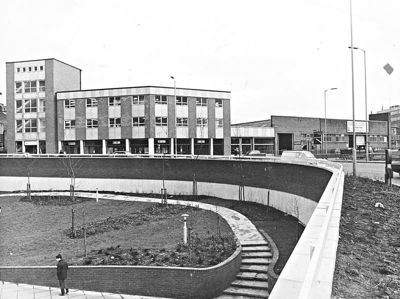
8. Modern motoring meets sunken gardens at Bradburn & Wedge
Walking past freshly laid flowerbeds and curved brick retaining walls, a solitary pedestrian explores the newly completed sunken garden features bordering Wolverhampton's expanding ring road system in March 1969. Rising prominently behind the landscaped subway steps, the sleek 1960s showroom of well-known local motor dealership Bradburn & Wedge highlights the bold modernisation reshaping the town centre's urban layout. | Express & Star archive