
First mapped out in the mid-1950s and built in stages throughout the 1960s, 1970s and early 1980s, Wolverhampton's inner ring road transformed the town centre. Historic pubs, terraced streets and industrial sites gave way to multi-lane carriageways, concrete flyovers and sunken pedestrian subways.
Captured from high above the traffic and at ground level in its mosaic-lined underpasses and sunken gardens, these archive photographs offer a fascinating look at the changing landscape, the ambitious engineering behind the project and the everyday lives of the drivers and pedestrians who used it.
The photographs are presented in no particular order, but together they capture the changing face of Wolverhampton's ring road. Do you remember it being built, or have memories of using it over the years? Share your memories in the comments – we'd love to hear them.
- You can enjoy this and more with our weekly FREE Nostalgia Newsletter - with scores of archive pictures and exclusive features on the history of Wolverhampton, Staffordshire and the Black Country - all sent to your inbox every week. Sign up here
- For anyone curious about where their own family story leads, MyHeritage DNA kits are currently £19.90, excluding shipping. The test can help explore genetic origins and identify DNA matches who may share branches of your family tree. This is an affiliate link. We may earn a small commission on items purchased, but that does not affect our editorial judgement
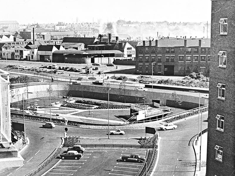
1. Sunken gardens take shape at Graiseley
Looking down from the upper floors of Graiseley Court Flats in September 1966, this elevated view captures the newly laid out sunken gardens nestled inside the ring road island. Framed by sweeping traffic lanes, subways, and crisp landscaped walkways, the modern road scheme offers a striking contrast against the smoky, industrial townscape stretching across the horizon. | Express & Star archive
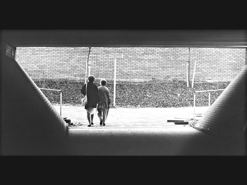
2. Stepping out from the subway towards the Royal Hospital
Emerging from the concrete shelter of a pedestrian underpass, two shoppers step out into the daylight along Wolverhampton's ring road during the 1980s. Framed by the tunnel's curved tiled walls and metal handrails, the scene looks toward a directional signpost pointing the way to the Royal Hospital against a backdrop of brick retaining walls and newly planted saplings. | Express & Star archive
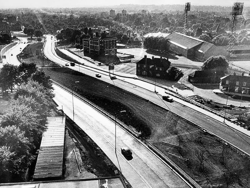
3. High-rise views of the fourth stage
Captured from the tower block of the Wolverhampton Polytechnic on Waterloo Road on August 19, 1970, this elevated view looks out across the fourth stage of the city's evolving ring road. Sweeping cleanly past the historic Molineux Hotel and the towering floodlights of the Wolves ground at the top of the frame, the freshly laid dual carriageway showcases the ambitious mid-century road building reshaping the town centre. | Express & Star archive
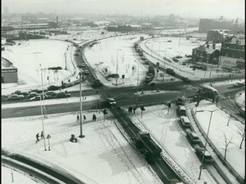
4. Winter gridlock brings traffic to a crawl
Blanketed in thick snow and treacherous ice, a major junction of Wolverhampton's ring road slows to a standstill during one of the coldest snaps of the decade in January 1982. Captured from a bird's-eye vantage point, motorists crawl through narrowed, slushy lanes while pedestrians carefully pick their way across frozen footpaths and the icy carriageway. | Express & Star archive