Snow and ice weather warnings extended into weekend
Warnings cover much of the UK.
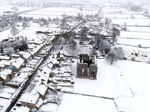
Fresh weather warnings for snow and ice over the weekend have been issued as Arctic air sweeps in.
Yellow weather warnings for snow and ice are already in place across parts of the UK and forecasters warn the wintry conditions will continue in the coming days.
An Arctic Maritime air mass is bringing colder conditions from the north of Scotland southwards, the Met Office said.
In Scotland and northern England yellow weather warnings for snow and ice are in force until midday on Friday.
The Met Office has now issued a yellow warning over snow and ice for northern Scotland, Orkney and Shetland, Angus, Perth and Kinross, north-east England and Yorkshire and Humber, which will be in place from 4pm on Friday until 10am on Saturday.
Forecasters predict snow showers and hail on Friday afternoon, evening and overnight may lead to accumulations of 1-3cm in places, while sleet is more likely along some coastal areas.
They warn that there may be some travel disruption to bus and train services and on the roads.
A yellow warning for ice has been issued for Northern Ireland which will be in place from 8pm on Friday until 10am on Saturday.
The Met Office has also issued a yellow warning over ice for Wales and central and southern England which comes into force at 5pm on Friday and runs until 10am the following day.
Another yellow warning for snow in northern England and most of Scotland comes into force at 9pm on Saturday and lasts until 10am on Sunday.
It warns that snow, which may be heavy at times, may cause some disruption to travel, especially over high ground during Saturday night and Sunday morning.

The Met Office said: “Outbreaks of rain spreading eastwards on Saturday night will fall as snow initially, even to low levels for a time, before becoming confined to higher ground as milder air arrives from the west.
“Temporary snow accumulations of 1-3cm will be possible at low levels, with 3-7cm possible above about 150m elevation, and perhaps 10-15cm above 400m.”
It said that ice will be another hazard, particularly across north-east England and parts of Scotland where precipitation could fall on frozen ground leading to “very slippery” conditions.