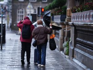
Flood warnings in place as Storm Chandra brings heavy rain and strong winds to the Black Country and Staffordshire
Residents across the region have been warned of the possibility of disruption throughout the day as Storm Chandra makes an impact.
One flood warning is in place near Halesowen, while seven flood alerts have been put up by the Government flooding service for areas across the Black Country and Staffordshire as Storm Chandra brought a night of heavy rain.
Residents living near Illey Brook at Halesowen have been warned to expect possible flooding after the water level of 0.90 metres was passed, with properties and roads around Chadbury Road and Woodman Close expected to be affected.
The Flood Service said: "High river levels are expected to cause flooding today.
"Flooding may affect properties and roads around Chadbury Road and Woodman Close.
"We are closely monitoring the situation. Start acting on your flood plan if you have one .
"The Illey Brook level at Halesowen Manor Way was 0.95 metres. Property flooding is possible when it goes above 0.90 metres."
The alerts have been put in place at Bourne Brook (Tamworth), which covers Shenstone, at River Blythe in Warwickshire, which covers the area near Birmingham Airport, River Rea, which runs through central Birmingham, River Sow and River Penk, River Stour, Smestow Brook in the Black Country and South Staffordshire and Upper Tame and Brooks in the Wyre Forest.
The Flood Service said the alert would remain in place at Bourne Brook (Tamworth) until 11am on Wednesday, while the other alerts would remain in place until 11am today or as the situation changes.
For Bourne Brook (Tamworth), Flooding may affect low-lying land and roads adjacent to the Bourne Brook, while for River Blythe in Warwickshire, flooding may affect low-lying land and roads adjacent to the River Blythe between Cheswick Green and Blyth End.
For River Rea, flooding may affect low-lying land and roads adjacent to the River Rea between Longbridge and Nechells including Northfield, Kings Norton, Lifford, Stirchley, Selly Park and Digbeth, while for River Sow and River Penk, flooding may affect low-lying land and roads adjacent to the River Sow between Great Bridgeford and Shugborough, the River Penk between Coven and Stafford, the Sandyford Brook, the Rising Brook, the Ridings Brook and the Saredon Brook.
For River Stour and Smestow Brook, flooding may affect low lying land and roads around Halesowen, Stourbridge, Wombourne, Kingswinford and Kinver and, for Upper Tame, flooding may affect low-lying land and roads adjacent to the River Tame between Horseley Heath and Castle Vale and the Ford Brook between Walsall and Bescot.
Finally, for Brooks in the Wyre Forest, flooding may affect low lying land and roads adjacent to the river from Acton Round to Noutards Green. Other locations that may be affected include Morville, Eardington, Highley, Wribbenhall and Rock.
A yellow warning for rain is in place from midnight until midday on Tuesday for much of south-east England, and for south-west England and south and central Wales from 1pm on Monday to 10am on Tuesday.
Met Office chief forecaster Paul Gundersen said: “Initially, strong winds will impact the Isles of Scilly, western Cornwall and south-west Wales which are still vulnerable after Storm Goretti, gusts of 70 to 80mph are possible here.
“Heavy rain is an additional hazard as it falls on saturated ground in Dorset and southern parts of Devon, Somerset and Cornwall.
“As Chandra interacts with colder air further north snow becomes a hazard, with 10-20cm of snow possibly accumulating over higher ground in the Pennines, southern Scotland and the Highlands.
“With a complex spell of weather, its important people stay up to date with the forecast and any warnings in your area.”
RAC mobile servicing and repairs team leader Nick Mullender said: “Flooding is highly likely, making many roads dangerous. Our message to drivers is simple: do not drive through standing water unless you are completely certain the water is shallow enough and it’s safe to do so.
“In these conditions, drivers need to slow down and stay alert. Wet roads can double stopping distances, so taking a cautious, steady approach and allowing extra time to react is essential.
“And if your vehicle already has known faults, now is not the time to take risks. Avoid unnecessary journeys and get issues fixed promptly by a trusted mobile mechanic or local garage.”
Storm Chandra is the next storm to be named by the western Europe storm naming group list shared between the UK, Ireland and Netherlands


