West Midlands hit by heavy rain amid weather warnings across the UK - here’s when the downpours are due in and around Wolverhampton
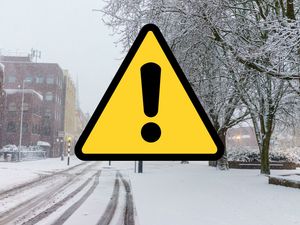
The Met Office has issued amber and yellow weather warnings across the UK - just missing the Black Country and Staffordshire despite the heavy downpours
An amber rain warning for possible danger to life has come into force in parts of Wales, alongside several yellow warnings across the UK.
The Met Office says heavy rain is expected in south and south-west Wales, with 50mm to 80mm forecast widely and nearly 100mm in some areas, the Met Office said.
Homes and businesses are likely to be flooded and some communities could be cut off, according to the amber warning that started at 3am and runs until 9pm on Monday.
Yellow rain warnings are in place for parts of north-east, north-west and south-west England, the East Midlands, the West Midlands (Stoke and Hereford) and Wales.
The Environment Agency (EA) has posted seven warnings saying flooding is expected, including for parts of the Lake District.
There are also 79 active EA alerts saying flooding is possible.
A yellow rain warning is active for the East Midlands, the West Midlands (Stoke and Hereford), north-east and north-west England and parts of Wales until 11.59pm on Monday.
Fast-flowing or deep floodwater is possible in those areas and could cause a danger to life, the Met Office said.
Forecasters warned that heavy rain could cause travel disruption, cut off communities and bring power cuts.
Met Office weather forecast for the Black Country - when rain is due
It's been a wet morning for many of us and the drab weather isn't due to end any time soon. According to the Met Office latest forecast, heavy rain is due from 7pm to continue right up until 11pm this evening. Wind is also persistent with gusts reaching up to 24mph. Tomorrow does look brighter though.
This Evening and Tonight:
Staying very wet for many this evening with the potential for some localised flooding and travel disruption. Further rain overnight but turning drier from the west through the early hours, with clearer skies developing. A chillier night than recently. Minimum temperature 4 °C.
Tuesday:
Any early morning mist patches clearing, then a dry and increasingly bright day with glimmers of sunshine at times, especially later. Not as mild, but with a light westerly breeze. Maximum temperature 8 °C.
Outlook for Wednesday to Friday:
Turning windier on Wednesday with periods of rain in places, this perhaps heavier and more persistent by Thursday. Bright and breezy on Friday with sunshine and isolated showers. Staying mild.