West Midlands weather outlook as severe warnings in place across UK - latest Met Office update
The Met Office has update on its forecast for the West Midlands as amber alerts are issued for parts of the UK
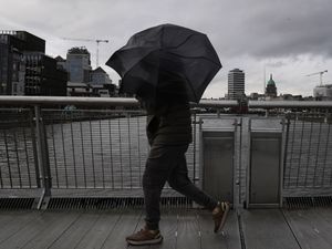
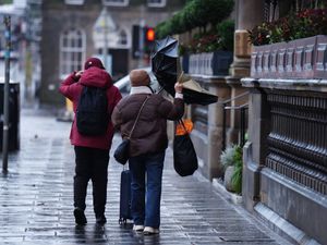
The West Midlands is set for a mostly dry and mild start to next week, despite amber and yellow severe weather warnings for rain across parts of the UK.
Flood alerts remain in place in areas of the West Midlands, as river levels remain high, with residents urged to stay vigilant and be prepared for possible flooding.
A Met Office amber weather warning is currently in force with "very heavy and persistent rain" expected to continue into next week, with a potential danger to life in some areas.
Homes and businesses in parts of northern England and south-west Scotland are likely to become flooded on Sunday and Monday, the forecaster warned.
Flood alerts remain in place in Shropshire and Worcestershire. The Environment Agency said river levels remain high but are falling, although the risk of flooding continues.
Areas that may be affected include Highley to Tewkesbury, Bewdley and Stourport. Meanwhile, in Shropshire, locations that may be affected include White Abbey, Coalbrookdale, Ironbridge, Bridgnorth, Shrewsbury, Market Drayton, Wem, and Rodington.
Despite the warnings, the West Midlands is expected to experience a mostly dry and mild spell next week, with temperatures above average for December.
The Met Office said Sunday will be cloudier and windier than Saturday, though largely dry. A few showers are possible, particularly across northern and western parts of the region, while the south and east may see the best of any brighter spells. Temperatures will reach a maximum of around 11°C.
Clouds will thicken overnight, with rain moving into northern and western areas. Elsewhere it should remain mostly dry as winds ease. Temperatures will fall to around 8°C during another mild, frost-free night.
Monday is expected to remain mostly cloudy, with occasional rain mainly in the north and west. Brighter spells are possible in the south-east, and daytime highs will reach around 11°C.
Looking further ahead, rain overnight into Tuesday will clear to give more settled conditions as high pressure builds. However, unsettled, wet, and windy weather is expected to return on Wednesday and Thursday, with temperatures continuing to remain above average.
The amber rain warning, which came into effect at midnight on Sunday, covers south-west Scotland including Dumfries and Galloway, the Lothian Borders and Strathclyde.
Some areas could see 110mm to 130mm of rainfall before the alert expires at 11.59pm tonight. Another amber alert is in effect for Cumbria, lasting until 6pm on Monday.
Marco Petagna, meteorologist at the Met Office, said: “Really, it’s a very slow moving band (of rain). That’s why we’re going to see those high rainfall totals.
“So the warnings are out quite widely across the sort of north-west of the UK, even down into Wales as well.
“Over the next few days, we’re looking at 20mm to 70mm towards the north-west of the UK, so one to three inches of rain, fairly widely.
“In those amber warning areas, we could see 200mm or more,” Mr Petagna added.
“So that’s eight inches or more – and yes, obviously, quite likely to give some flooding issues over the next few days.”
A yellow rain alert remains in place across South West Scotland, Central, Tayside and Fife, Highlands and Eilean Siar until 11.59pm on Sunday.
Further warnings cover parts of England, including the East Midlands, North East England, North West England, Yorkshire and Humber, until 6pm on Monday.