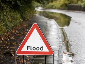
Flood warnings and alerts still in place across West Midlands after night of heavy rain
Communities across the West Midlands have been warned of the possibility of flooding as the region feels the after effects of Storm Claudia.
The Environment Agency has released a flood warning and four flood alerts across the West Midlands after a night of heavy rain from the storm.
The warning is in place for Saredon Brook at Standeford near Coven, with the Environment Agency saying the area, which is near the A449 Stafford Road, is expected to flood.
A message from the Environment Agency said: "High river levels are expected to cause flooding today.
"Flooding may affect properties and roads around the Stafford Road area.
"We are closely monitoring the situation. Stay away from floodwater as it contains hidden dangers such as open manhole covers, sewage and chemicals.
"The Saredon Brook level at Deepmore Farm was 1.34 metres. Property flooding is possible when it goes above 1.50 metres."
This message will be updated by 11am on November 16 or as the situation changes."
The four alerts are all in place for the River Sow and River Penk, the River Stour and Smestow Brook in the Black Country and South Staffordshire, the River Worfe in Bridgnorth and the Upper Tame.
For the River Sow and River Penk, the Environment Agency said: "High river levels today may lead to flooding.
"Flooding may affect low-lying land and roads adjacent to the River Sow between Great Bridgeford and Shugborough, the River Penk between Coven and Stafford, the Sandyford Brook, the Rising Brook, the Ridings Brook and the Saredon Brook.
"We are closely monitoring the situation and clearing blockages from debris screens.
"Take care and avoid walking, cycling or driving through flood water.
"This message will be updated by 11am on November 16 or as the situation changes."
For the River Stour and Smestow Brook, the Environment Agency said: "High river levels today may lead to flooding.
"Flooding may affect low lying land and roads around Halesowen, Stourbridge. Wombourne, Kingswinford and Kinver.
"We are closely monitoring the situation and clearing blockages from debris screens.
"Take care and avoid walking, cycling or driving through flood water.
"This message will be updated by 11am on November 16 or as the situation changes."
For the River Worfe, the Environment Agency said: "High river levels today may lead to flooding.
"Flooding may affect low lying land and roads adjacent to the river from Crackley Bank to Bridgnorth.
"Other locations that may be affected include Ryton and Burcote. Water is rising in the drains at Worfield.
"We are closely monitoring the situation.
"Take care and avoid walking, cycling or driving through flood water.
"This message will be updated by 9am on November 16 or as the situation changes."
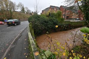
An area of Halesowen had also been hit by flooding over night near Corngreaves Road and Belle View, with the road flooded on Friday night, but having cleared by midday on Saturday.