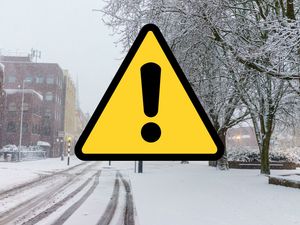
Flood warnings and alerts issued after heavy rain in the Black Country and Staffordshire
There are warnings of floods across the region after a night of heavy rain took its toll on rivers and waterways.
The Government's flooding website put up a flood warning for Illey Brook at Halesowen on Tuesday night after heavy showers in the area, saying that flooding would affect roads around the A459 and surrounding area.
It also said on Wednesday morning that the level was 0.26 metres, with property flooding possible when the level goes above 0.90 metres.
A spokesman for the Government Flooding Service said on Tuesday: "Rising river levels are causing flooding this evening.
"Flooding is expected during the evening and may affect properties and roads around the A459, Grange Crescent and Hayseech Road.
"We are monitoring rainfall and river levels."
A further update on Wednesday morning said: "The Illey Brook level at Halesowen Manor Way was 0.26 metres. Property flooding is possible when it goes above 0.90 metres."
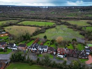
A further alert was made on Tuesday night for the River Stour and Smestow Brook in the Black Country and South Staffordshire, with warnings of low lying land and roads around Halesowen, Stourbridge, Wombourne, Kingswinford and Kinver being affected.
A message at the time said: "Flooding is possible from 11pm and may affect low lying land and roads around Halesowen, Stourbridge. Wombourne, Kingswinford and Kinver.
"We are monitoring rainfall and river levels.
"Take care and avoid walking, cycling or driving through flood water .
"This message will be updated by 11am on November 12 or as the situation changes."
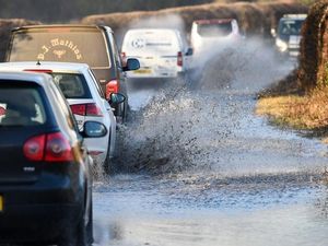
On Wednesday morning, new alerts were highlighted for the River Stour in Worcestershire and the River Severn in Shropshire.
For the River Stour, a spokesman for the Government Flooding Service said: "Flooding is possible on November 12 and may affect low lying land and roads adjacent to the river from Caunsall to Stourport.
"Other locations that may be affected include Wolverley and Cookley, Blakedown and Kidderminster.
"We are closely monitoring the situation.
"Take care and avoid walking, cycling or driving through flood water and monitor local water levels and weather conditions.
"This message will be updated by 7pm on November 12 or as the situation changes."
For the River Severn, a spokesman for the Government Flooding Service said: " Flooding is possible on November 12 and may affect low lying land and roads adjacent the river from Shrewsbury to Upper Arley.
"Locations that may be affected are White Abbey, Coalbrookdale, Ironbridge and Bridgnorth.
"River Severn bankfull at White Abbey, floodplain may be filling at Hayes Basin.
"Predicted peaks are Crew Green 4.4m to 4.7m on November 12 afternoon, Montford 4.4m to 4.9m on November 13 Afternoon and Welshbridge 2.2m to 2.6m on November 13 afternoon. We are closely monitoring the situation.
"Take care and avoid walking, cycling or driving through flood water and monitor local water levels and weather conditions.
"This message will be updated by 7pm on November 12 or as the situation changes."