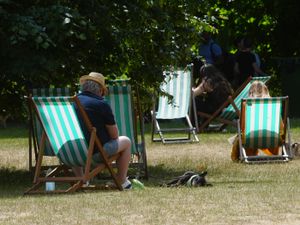
West Midlands weather: Met Office forecasts temperatures to reach 29°C - when could the warm weather return?
Watch the Met Office’s Deep Dive video forecast, as temperatures are predicted to reach 29°C in the West Midlands.
The Met Office is forecasting temperatures to reach the high 20s in the West Midlands next week.
What is the weather forecast for the remainder of the week?
Wednesday (August 6) is forecast to be a relatively dry day with a mixture of cloud and sunny spells, focus shifts to the northwest later in the evening with a period of further wet and windy weather for some likely late on Wednesday and into Thursday.
Mike Silverstone, deputy chief meteorologist at the Met Office, said: “While the system later this week won’t carry as many impacts as Storm Floris, a further period of unseasonable wet and windy weather is on the way late on Wednesday and into Thursday for those in northwestern parts of the UK.
“An area of low pressure from the west will bring some strong winds, especially for those in western parts of Scotland. Gusts over 50mph are possible for a time. Some heavy rain will also accompany the strong winds, with up to 30mm possible.”
Those further south will see less in the way of high rainfall totals on Thursday as fronts move gradually south and east, though an unsettled feeling to the weather is likely for many with temperatures around average.
When will the heat return?
The Met Office long-range forecast says above average temperatures are more likely than not during the period of August 10 to August 19.
Met Office long-range forecast
August 10 to August 19
The start of this period may bring some strong winds and rain to the north of the UK before an Atlantic weather system erratically crosses all parts. Ahead of this, potential for some very warm and humid weather to affect parts of the south and east in particular. Looking towards mid-August, and high pressure is more likely to dominate the weather across the UK. This will bring plenty of a dry weather for the most part, though northern areas may see a rather more changeable theme with occasional rain or showers and breezier conditions at times. Above average temperatures are more likely than not, especially in the south, where it could also be rather humid.
August 20 to September 3
High pressure, and therefore largely settled conditions overall, appears more likely for the second half of August. Although dry weather is likely to dominate, periods of rain or showers and thunderstorms may develop at times. Above average temperatures overall seem most likely, with the potential for hot spells to develop, especially in the east and south. By early September, there are signals for high pressure to become less dominant with perhaps a greater chance of some rain, though there is some uncertainty in this aspect of the forecast.
Alex Burkill, Met Office meteorologist, said: “As we go through into the weekend, the direction that we’re dragging in our air, the winds backing round to get more of that southerly flow, we’re likely to drag some more warm air in across the UK, and that’s likely to lead to our temperature rising.
“So whilst across northern parts of the UK, Sunday looks like it could be quite wet, it could be quite windy. Across the south, yes there’ll probably be some relatively blustery winds around, temperatures if anything are going to rise and even across northern parts temperatures are going to rise as well.
“There’s fairly good consensus that temperatures are going to be above average and in some cases significantly above average as we go through into next week so we could have some hot weather at times as well.”
Forecast West Midlands temperatures next week
The Met Office is forecasting temperatures of 29°C in Worcester, 28°C for Coventry and Hereford, 27°C for Birmingham, Solihull, Worcester and 26°C for Stoke-on-Trent, Wolverhampton, Dudley, Shrewsbury and Lichfield on August 12.