Is the heatwave over? Not according to the Met Office - here's when scorching temperatures are set to return to the West Midlands
Residents in the West Midlands may be forgiven in thinking normal service is resumed as the rain and clouds affect the county following weeks of sunshine.
But is the heatwave that saw temperatures last month approach record-levels for June now over?
Not say the Met Office, who have said Sunday's downpours are just a blip.
According the meteorological service, Sunday's overcast weather is set to end by the evening.
The sun is set to return to Wolverhampton, the Black Country and rest of the West Midlands on Monday. While the morning may start with a few scattered showers, by lunchtime temperatures are set to reach 21C degrees.
And things are only set to improve all week.
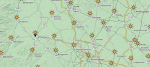
Wednesday will see highs of 25C Degrees, but the mercury is set to rise to 29C Degrees by Friday – with the sun set to last well into next weekend.
Marco Petagna, senior meteorologist at the Met Office, said the UK is set for its third heatwave of the year by the end of the week.
He said: “The headline is a changeable theme to the next couple of days and then the weather will become more settled as we go into next week.
“It could well reach heatwave criteria again across England and Wales towards the end of next week.
“In the short term, it’s quite a mixed picture. There’s a lot of cloud around, and bits and pieces of showery rain around.
“Across the East of England, the weather could turn heavy and thundery and there’s a warning out for thunderstorms between 7am to 7pm, because of the unsettled atmosphere.
“We could see an inch or two of rain and several thunderstorms there on Sunday, and that showery scene continues into Monday as well, especially in the north and east of the UK.”