King Charles coastal path opens to the public - letting walkers explore entire English shoreline
The King Charles III England Coast Path has officially been inaugurated, stretching around the entire coast of England.
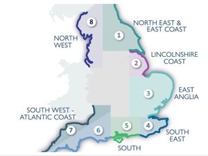
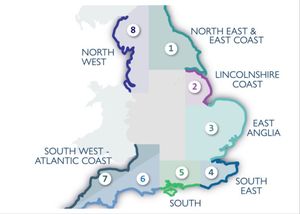
At 2,689 miles long it is the longest managed coastal walking route in the world, according to Natural England, the government body which created it.
The King Charles III England Coast Path is a continuous trail allowing walkers to explore England's shoreline step by step.
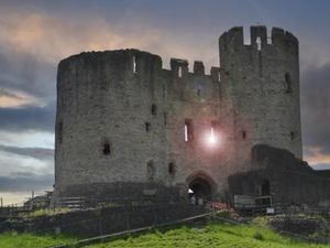
It passes through some of the country's most beautiful and varied landscapes, from salt marshes and sandy beaches to cliffs, dunes and historic coastal towns.
Among the highlights is the iconic chalk downland of the Seven Sisters in East Sussex.
More than 1,000 miles of new paths have been created, and many other sections upgraded.
Significant accessibility improvements have been made throughout, including removing stiles, resurfacing paths, building boardwalks, and installing bridges to make the route more usable for walkers of varying abilities.
Planners have built flexibility into the route's design, incorporating a "roll back" mechanism that allows the path to shift inland as coastal erosion reshapes the shoreline.
The project was initiated during Gordon Brown's Government, and it has taken 18 years and seven prime ministers to get to this stage.
About 80 per cent of the route is now open and most of the rest of the path is due to be completed by the end of the year.
Once fully open, it’ll be the longest managed coastal path in the entire world.
In a few places, walkers must briefly leave the trail. In northwest England, for example, a ferry across the Mersey is needed to follow the route.
National Trails said on its website: "You may find some minor diversions and seasonal or tidal alternatives on the route – please follow instructions on signage as these are for the safety of both walkers and wildlife.
"Diversions are also shown on each region’s interactive map which you can view by selecting a region."
If you want to walk some – maybe even all – of the King Charles III England Coast Path, you can access route maps on the National Trails website.