
You get a different perspective on Wolverhampton when looking from high above.
Up there with a bird’s eye view the city is laid out like a map below and you see so much more. There have been dramatic changes over the years which are brought into stark focus, such as the ring road which has carved its way through the cityscape, and the Mander Centre which transformed the centre.
Now here’s a question - was Wolverhampton a better place before the major developments of the 1960s and 1970s, or did they make the town, as it was then, keep pace with the needs of the modern world?
Judge for yourselves as we take flight above the city and enjoy a selection of pictures from down the decades and share your memories and views in the comments.
- You can enjoy this and more with our weekly FREE Nostalgia Newsletter - with scores of archive pictures and exclusive features on the history of Wolverhampton, Staffordshire and the Black Country - all sent to your inbox every week. Sign up here
- For anyone curious about where their own family story leads, MyHeritage DNA kits are currently £19.90, excluding shipping. The test can help explore genetic origins and identify DNA matches who may share branches of your family tree.
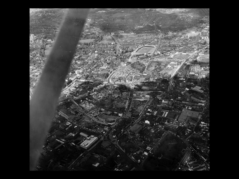
1. Transformation time
That's the wing strut of the aircraft on the left as we look at a Wolverhampton town centre about to be transformed. Although there is no date, work can be seen to be under way on the Mander Centre, but it is in the early stages. It opened in March 1968, so perhaps this picture was taken in 1967. The Molineux football ground, home of Wolves, is towards the top. St Peter's Church is just right of centre. | Express & Star archive
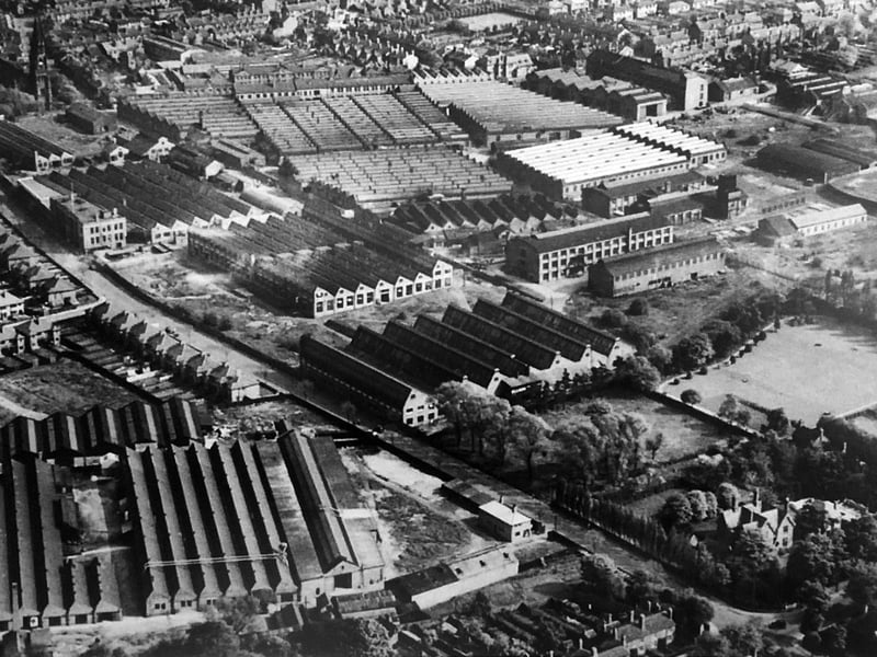
2. Plenty of targets to choose from
This is said to be a German reconnaissance picture of Blakenhall in 1940, in which case the Luftwaffe pilot was taking a risk coming so low. Mind you, the reward was plenty of juicy targets in sight. Upper left corner is St Luke's Church, which still stands on the junction of Moor Street and Upper Villiers Street. The road approaching us diagonally on the left lined by houses is Marston Road. The parallel road through the factories is Sunbeam Street, so presumably one of the factories is the Sunbeam works in Wolverhampton. | Mark Cooper/Express & Star archive
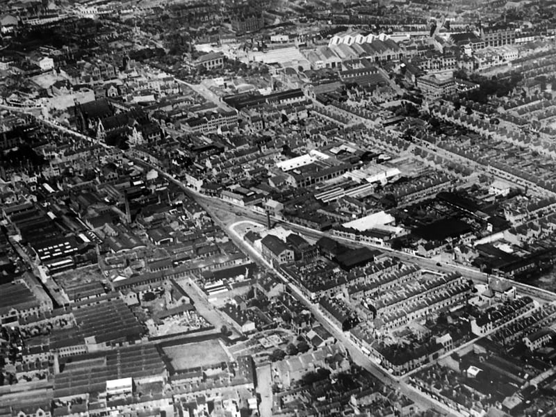
3. A jumble of industry and houses
The date on the back of this picture is said to be 1930, but it is also said to be another German reconnaissance picture. As the war didn't start until 1939, both can't be right, unless there was a very farsighted German pilot. The diagonal road upper left is Snow Hill leading to a distinctive V shaped junction. Top, just left of centre, is St George's Church. | Mark Cooper/Express & Star archive
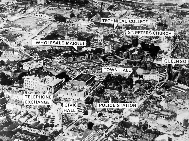
4. 1966 and all that
1966. A year to remember. England won the World Cup. And this picture was taken, with helpful labels to tell us what's what. There are large vacant expanses, almost like bomb sites - but they aren't. Wolverhampton was on the cusp of big changes. | Express & Star archive