
From high above in the skies the impact of the fire is clear on people’s homes and local community.
Officially, West Midlands Fire Service has said that its resources are split dealing with these affected areas: Quarry Park Road (and adjoining roads), Ounty John Lane, Racecourse Lane, Norton Road, Worcester Lane, Mount Rose Drive and Stourbridge Golf Course.
We know for sure that six properties are now affected by the Stourbridge fire and 40 acres are believed to be impacted including a wood.
These aerial pictures show how houses have been affected by the huge Stourbridge fire.
All photos taken by the Express & Star’s Chief Photographer Tim Thursfield:
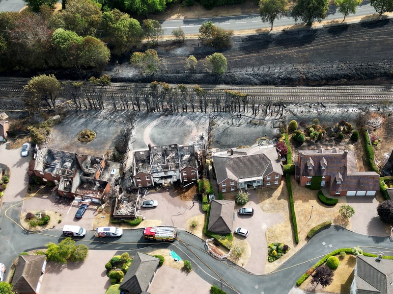
1. Aerial images showing impact of fire on homes
Aerial pics showing the houses affected by the huge Stourbridge fire. Tim Thursfield/Iconic Media Group | Iconic Media Resell

2. Aerial images showing impact of fire on homes
Aerial pics showing the houses affected by the huge Stourbridge fire. Tim Thursfield/Iconic Media Group | Iconic Media Resell
3. Aerial images showing impact of fire on homes
Aerial pics showing the houses affected by the huge Stourbridge fire. Tim Thursfield/Iconic Media Group | Iconic Media Resell
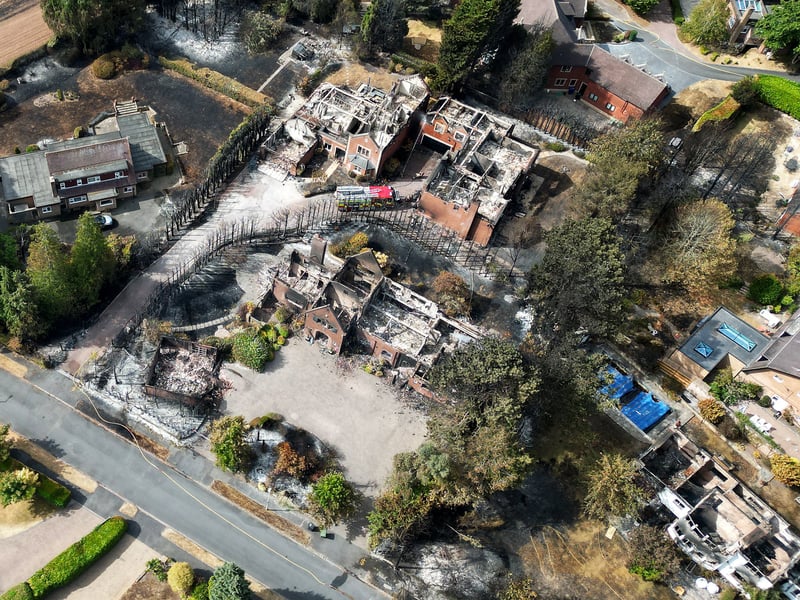
4. Aerial images showing impact of fire on homes
Aerial pics showing the houses affected by the huge Stourbridge fire. Tim Thursfield/Iconic Media Group | Iconic Media Resell