Stunning views and hidden gems on Wolverhampton trail
A new 29-mile route around Wolverhampton taking in towpaths, tracks, footpaths and old railways is just the ticket to help more residents discover the city's hidden gems.
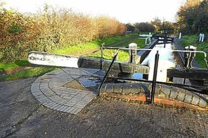
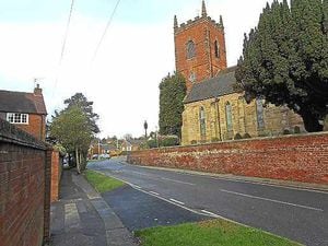
From picturesque canal locks to church towers, village greens, and hill top views 'A Wolverhampton Ring' has it all.
The circuit has been split into a series of walks covering areas like Compton, Tettenhall, Bushbury, Northycote, Castlecroft, Lower Penn, Penn, East Park, Sedgley, East Park, Wednesfield, Wood End and Coseley.
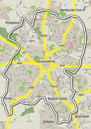
Each walk on the circuit is linked to popular bus routes that are marked out on each map to help participants get to their chosen walk and back home with relative ease.
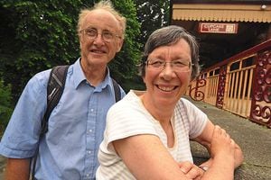
Its creators John and Janice Wallbridge are fully-fledged outdoor enthusiasts who have mapped out the manageable mini-walks to cover the North East area of the city from Wellington Road, Priestfield, to Bushbury; in the South East from Wednesfield Way, Wednesfield to the Upper Ettingshall Road, Sedgley; in the South West between the A454 Compton Road to Northway, Sedgley; and the north west from Bee Lane, Fordhouses, and to Compton Road, Compton.
Mr Wallbridge, of Newhampton Road West, said: "The idea came after we did a walk in London called the Capital Ring. It goes all round London and took us four days to complete.
"We thought it was a lovely idea, there were some good walks and it was well organised, with signposts and is supported by the London boroughs. We thought it would be nice if Wolverhampton had one too.
"The Ring is very much in the early stages, but the local Ramblers Association is interested in it and is taking it on board.
"So far I've designed some maps and we had some help setting up the website.
"The Capital ring is marked on Ordinance Maps so it will be good if we could get to that point one day. The idea is that it's nice for people to get out and get some exercise and it's a nice way to join up the city, for example, so that people in Wednesfield and Tettenhall, can see there is a link between their communities.
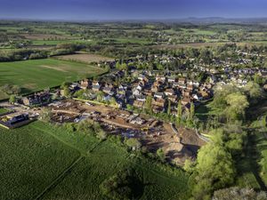
"The walk also ventures just outside of Wolverhampton because some of the best views of the city are out in neighbouring areas. For example, there are some great views from Sedgley Beacon. Others include a fantastic, but little known spot at Lower Green Tettenhall that I would say gives the best view of the whole city. There are also good views at Northycote, Wood End, across the border in Staffordshire at Lower Penn too.
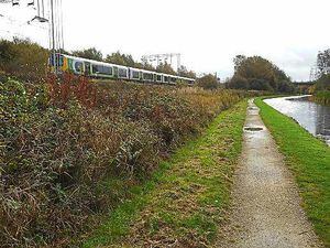
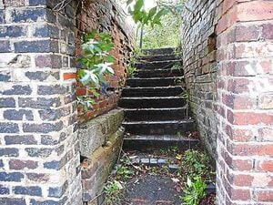
"As far as possible we tried to walk in green spaces and the routes include tracks, canal towpaths, footpaths, old railways and some roads. It's not always possible to avoid the roadways and we have to walk along pavements, for example, in Deepfields, Ettingshall and in Wednesfield."
The retired teacher, 65, says it took them a couple of months to devise the routes and maps.
The maps include keys for buildings of interest and landmarks like churches and pubs. Bus numbers are also marked to encourage residents to make use of public transport.